When available, the map view will display the device's GPS position and the cell tower's location that the device last connected to, as reported by the SIM. For the map to plot the GPS position, the device has to report longitude and latitude values in its data payload. Moreover, the system needs to know where these data values are in the payload. For this, a Data Lens needs to be associated with the device.
NB:
Unless a customer has specifically requested GPS capabilities we cannot provide the exact location of the device of cell tower. The blue pin indicates the center of the are the cell tower is in. The cell tower can be anymore within the blue circle presented in the image below.
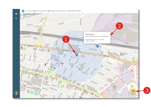
- Active Cell Tower. The system purposefully fuzzes the cell tower's position, and the blue circle indicates a radius of uncertainty.
- GPS Position. This pin indicates the GPS position as reported by the device.
- Add Manual Position Button. You can add a manual location where you expect the device to be.